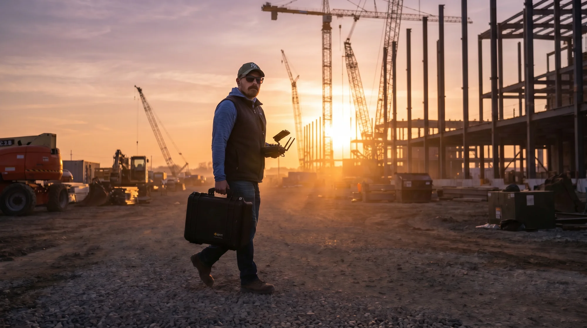
A few months ago, I wrote an article about why I left the creative industry after twenty years. That article was about the why. This one is about the what.
Because what nobody saw when that article came out: the hard work was already done. I had been preparing the move for a year.
I had already retrained. The licenses were obtained. The software was running. The first clients were in. I didn’t jump blind. I had already landed.
That was a deliberate choice. Prove first. Then talk.
More than sending a drone into the air
People hear “drone inspection” and think: you fly around a bit, take some photos, and that’s it. That’s maybe 10 percent of the work.
The rest is a world you don’t see from the outside. And it starts long before you take off.
In Europe, professional drone work falls under the regulations of EASA, the European Union Aviation Safety Agency. That regulation is risk-based. For simple flights at a distance from people, the Open category with an A1/A3 or A2 certificate suffices. But as soon as you work closer to infrastructure, buildings, or people — and with inspections that’s almost always the case — you’re in the Specific category. And that’s where the real work begins.
I fly under STS-01 and PDRA. These are standard scenarios with strict conditions. STS-01 means visual line of sight, controlled ground area, maximum flight altitude of 120 meters, with a drone that meets specific technical requirements, think of a mandatory FTS system (Flight Termination System) that can autonomously land the drone in case of signal loss, and in certain configurations a parachute system as an additional safety measure. PDRA works similarly, but without the requirement for a C5-labeled drone, in exchange for stricter operational ground restrictions. The difference sounds subtle, but it determines which drone you deploy, how you define your ground zone, and what documentation you prepare. And all variations to interpret and implement.
For more complex operations — flights beyond visual line of sight or above hazardous industrial sites, there’s the SORA methodology: a comprehensive risk analysis that determines how strict your operational framework needs to be. That’s not filling out a form. That’s weeks/months of work.
That operational manual is not a formality. It describes your procedures, your emergency scenarios, your maintenance program, your training policy, your communication protocols. It’s the document by which the aviation authority assesses whether you’re professional enough to be allowed to fly.
These aren’t things you work out on your own. It’s an exchange with the regulatory authorities. You submit, you receive feedback, you adjust, you resubmit, until the right documents, licenses, and approvals are in place. That process requires patience, precision, and perseverance. But the result is a foundation on which you can build as a professional.
And honestly: the technical complexity sometimes pales compared to the administrative complexity. But we’re happy to take that on too. Part of the job.
Precision as standard
In drone inspection, there’s no debate about taste or style. The result is either technically correct, or it isn’t. And technically correct starts with positioning.
RTK: Real-Time Kinematic, is a GPS correction system that works with a base station that sends real-time correction signals to the drone. The result: positioning with an accuracy of one to two centimeters. Not corrected after the fact, but live, during the flight. That’s fundamentally different from the standard GPS a consumer drone uses, where you easily have a margin of error of one to five meters.
There’s also PPK — Post-Processed Kinematic — where you apply the correction afterward based on log data. That’s cheaper in setup but requires more processing time.
In photogrammetry, the process of generating an accurate 2D or 3D model from overlapping aerial photographs, that positioning is crucial. An orthomosaic is a geometrically corrected aerial image in which every pixel has an exact coordinate. That’s not a pretty aerial photo. That’s measurable material. Engineers, architects, and surveyors work with it.
A point cloud goes a step further: millions of measurement points in three dimensions that together form a detailed model of a terrain, building, or installation. From that you can calculate volumes, measure deformations, map elevation differences. For large buildings I create complete 3D models that document the current state of a structure, usable for maintenance, renovation, or insurance purposes. For industrial sites I process large-scale thermal inspections covering hundreds of panels or hectares of terrain. Volume measurements of stockpiles on construction sites or in terminals, where a surveyor used to spend days, I deliver from the air with survey-grade accuracy in a fraction of that time.
With software I process that data into usable deliverables. No experiment. Standard work.
Ground Control Points: GCPs, are physical reference points that you place on the terrain before the flight and measure with high precision, often with an RTK rover or total station. They form the link between your aerial images and the actual coordinate system on earth. Without GCPs, your model can look visually perfect, but be centimeters to decimeters off from reality geographically. With GCPs you anchor your data to the national reference system, in Belgium that’s Lambert 72 or ETRS89, so your results are usable for surveyors, engineers, and government bodies working with exact coordinates.
In practice, that means: before the drone takes off, I walk the terrain, place the markers, measure them in, and document the positions. That’s not the most spectacular part of the work. But it’s the part that determines whether your deliverable is professionally usable or not.
These are simple terms that can be explained in a few sentences and it’s just a handful from the basket full of terms and techniques that come into play. But there’s a steep learning curve involved in truly understanding them and applying them in practice. The difference between knowing the theory and making the right choices on an industrial site under changing conditions, that’s where the expertise lies. That’s not something you learn from a tutorial. That’s something you learn by doing it, time after time, on different terrains, under varying conditions.
Every term and many beyond those, that you read here, I had to study, research, validate, learn. Use. And then use again, until it became routine. That was a process of months. A little over a year, if I’m honest. With my ever-present passion and drive, a lot of focus, too little sleep, and a whole series of eureka moments, I now stand where I stand.
Thermography: seeing what the eye cannot see
A thermal camera on a drone is more than a gadget with pretty color images. It’s a measuring instrument.
During solar panel inspections I detect hotspots, cells that are overheating due to defects, dirt, or degradation. A defective cell not only produces less energy, it can also affect the rest of the string. On a roof with hundreds of panels, you can’t see that with the naked eye. With a radiometric thermal camera, you see it in minutes.
And it gets really interesting when you combine thermography with photogrammetry. For large solar parks I stitch thousands of thermal images together into one large thermal overview image, a thermal orthomosaic. Hectares of panels at a single glance. Every anomaly, every hotspot, every deviation immediately visible on one map. Two techniques combined into one deliverable. That’s the kind of work that energizes me.
For building inspections I map heat leaks. Poor insulation, thermal bridges, moisture problems — all visible in the thermal image if you know what to look for and when to measure. Because timing is crucial: the temperature difference between inside and outside must be large enough, the sun shouldn’t be shining directly on the facade, and wind affects the results. That sounds like nuance. It’s the difference between a usable report and noise.
The data is radiometric, every pixel contains a temperature value. That means I can not only indicate where a problem is, but also quantify how severe it is. That’s what a client needs to make decisions.
Built everything myself, almost everything
I didn’t just learn a new trade. I also built an entire business around it.
A website that doesn’t just show what I do, but that functions as a work platform, including a tools environment where I centralize my own utilities. Risk calculations, flight zone planning, compliance checks, things that otherwise take hours, reduced to minutes. A quotation system that automatically generates price estimates based on location data, inspection types, and perimeters. Tools that convert KML files, GPS coordinates, and site data into interactive maps and budget overviews.
Beyond that, I obviously also use external tools and platforms. And in a number of areas, I’ve deliberately brought in a good partner. Because sitting on an island alone, that gets you nowhere. You can’t do everything yourself and you shouldn’t want to either. Knowing where your expertise ends and someone else’s begins, is also a skill.
In the post-production process I’ve automated quite a lot with scripts that process images and data via API. Processes that need to run all night, large datasets, heavy processing, run autonomously. I don’t need to stay up for that. In the morning I check the result and start with the substantive analysis. No time wasted on putting together a puzzle that a machine puts together faster and more accurately than I do.
And then there’s AI. I’ve built agents that take the research work and repetitive steps out of my workflow. But let me be very clear about this: the substantive and technical decisions are mine. The choices that require expertise, which anomaly is relevant, which methodology suits the terrain, what the client actually needs, no machine makes those for you. AI saves me time. What I do with that time, that’s where the difference lies.
Might sound excessive for a one-person company. It’s the exact opposite. Because I work alone, every step needs to be efficient. Every tool I build saves me time that I can spend in the field. And the field is where I want to be. Not behind a screen renaming the same folder for the hundredth time.
The biggest challenge
I’ve mastered the technology. I’ve mastered the regulations. I’ve built the tools. But the biggest challenge lies somewhere else.
Entering a new market where nobody knows you.
For twenty years I worked in one industry. I had a network, a name, a reputation. Now I’m standing in a completely different world and starting from zero. Not in terms of skills but in terms of visibility. Nobody in industry, construction, or the energy sector knows Niko Caignie and AirScout. Not yet.
The biggest work now lies in building that network. Becoming visible. Proving what you can do, with every project again. Earning trust from people who have never seen you work.
It’s working. It’s growing. Clients who come in keep coming back. The relationships I build are built on results, not on a pitch. But patience is a virtue. And that patience I’ve learned, even though it wasn’t my strongest suit, if I’m honest.
The learning curves
Let me lay it out. Because it’s not one learning curve. There are several, and they all hit at the same time.
A steep technical learning curve. New hardware, new software, new methodologies, new precision standards. Every project teaches you something new.
A steep administrative learning curve. Regulations, permits, operational manuals, compliance. Paperwork that sometimes feels more complex than the flight itself.
A steep commercial learning curve. Getting to know a market you don’t know. Learning how that market thinks, buys, decides. Positioning yourself as an unknown in a world full of established players.
And then the financial reality. Professional drones, sensors, RTK systems, software licenses, insurance, training, … that’s not pocket change.
If someone tells you that a career switch is “just a matter of doing it,” nod politely and ask if they’ve ever tried it themselves.
From pro to pro
This is the heart of the story.
I didn’t start over. I relocated my professionalism.
The same Niko. With the same drive, the same passion, and the same technical thoroughness. In a new industry.
Working twenty years in a trade doesn’t just teach you that trade. It teaches you how to master a trade. How to bring structure to chaos. How to impose discipline on yourself without anyone watching. How to see the difference between good enough and truly good. And how to find the courage to admit that you’re not good enough at something yet — and then go fix it.
That method is transferable. From photography to photogrammetry. From film production to flight planning. The context changes. The standard doesn’t.
Today I stand on rooftops, construction sites, and industrial terrains with the same focus as when I first went out with a camera twenty years ago. With curiosity. With the ambition to do it better than yesterday. And with the awareness that a craft is never finished.
And it feels like coming home.